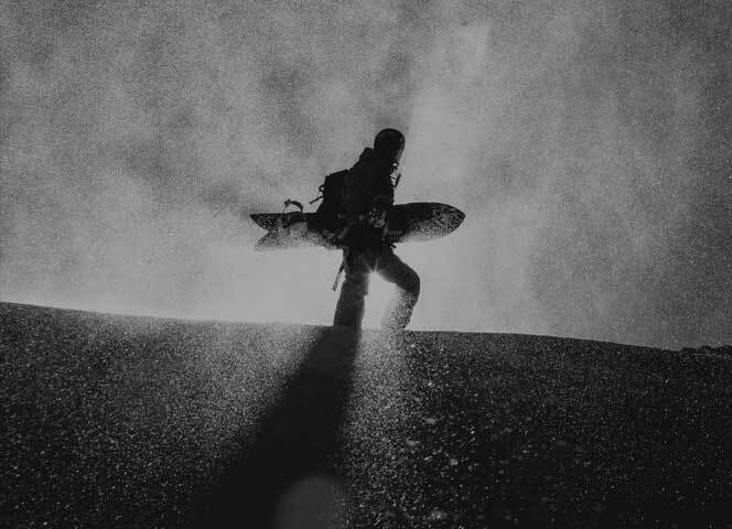


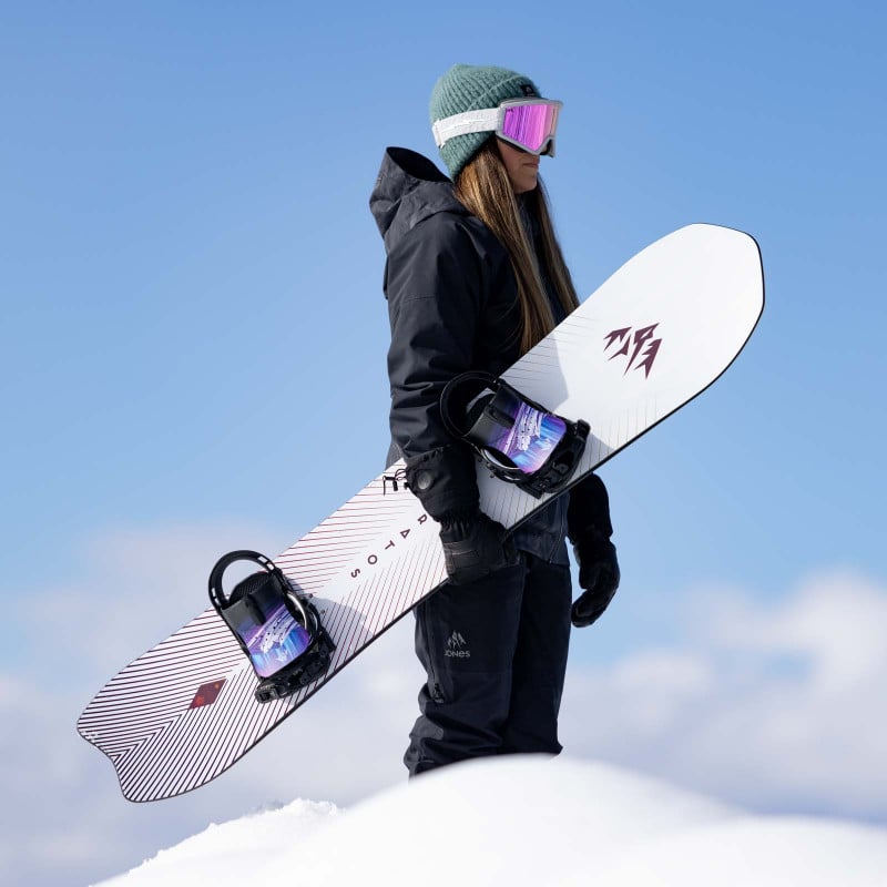
2021 Live Like Liz Award Trip Report
Splitboarding in the Brooks Range with Shira Ellenson
Excited to present a trip report from the 2021 Jones Live Like Liz Grant winner - Shira Ellenson of Fairbanks, Alaska.
In May 2021, Shira and a crew of friends used the grant to help fund a seven-day split/ski tour into the Brooks Range in Northern Alaska. Located in the Arctic circle, the Brooks Range holds the highest peaks at that latitude in the world and is one of the most remote wilderness areas in North America.
While weather and snow conditions forced them to change their tour plans enroute, Shira’s crew kept on the hunt for good snow and found awesome lines and sparkling dry pow by playing their aspects and elevations just right. And beyond just fun turns, they got to hang with the wild locals, including caribou, moose, mountain goats and thousands of migrating birds, in a place few will ever step foot.
Check out Shira’s trip report and photos to get inspired to start working on your application for the 2022 Jones Adventure Grants.
Midnight Sun: Touring in the Central Brooks Range
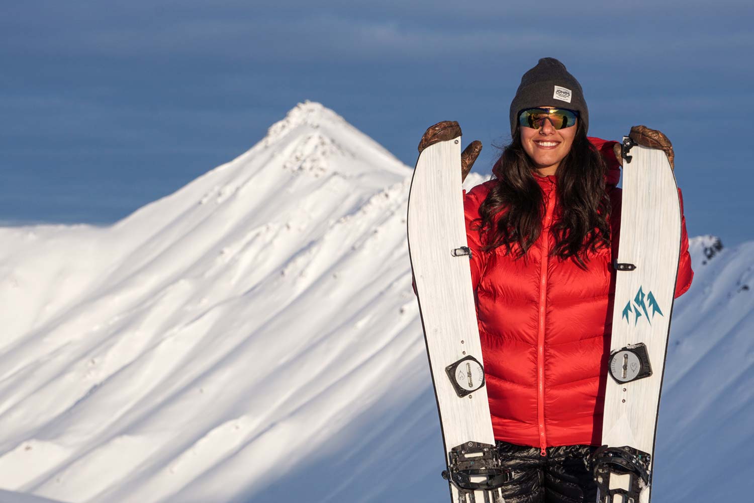
Trip Report by Shira Ellenson and Jocelyn Leroux
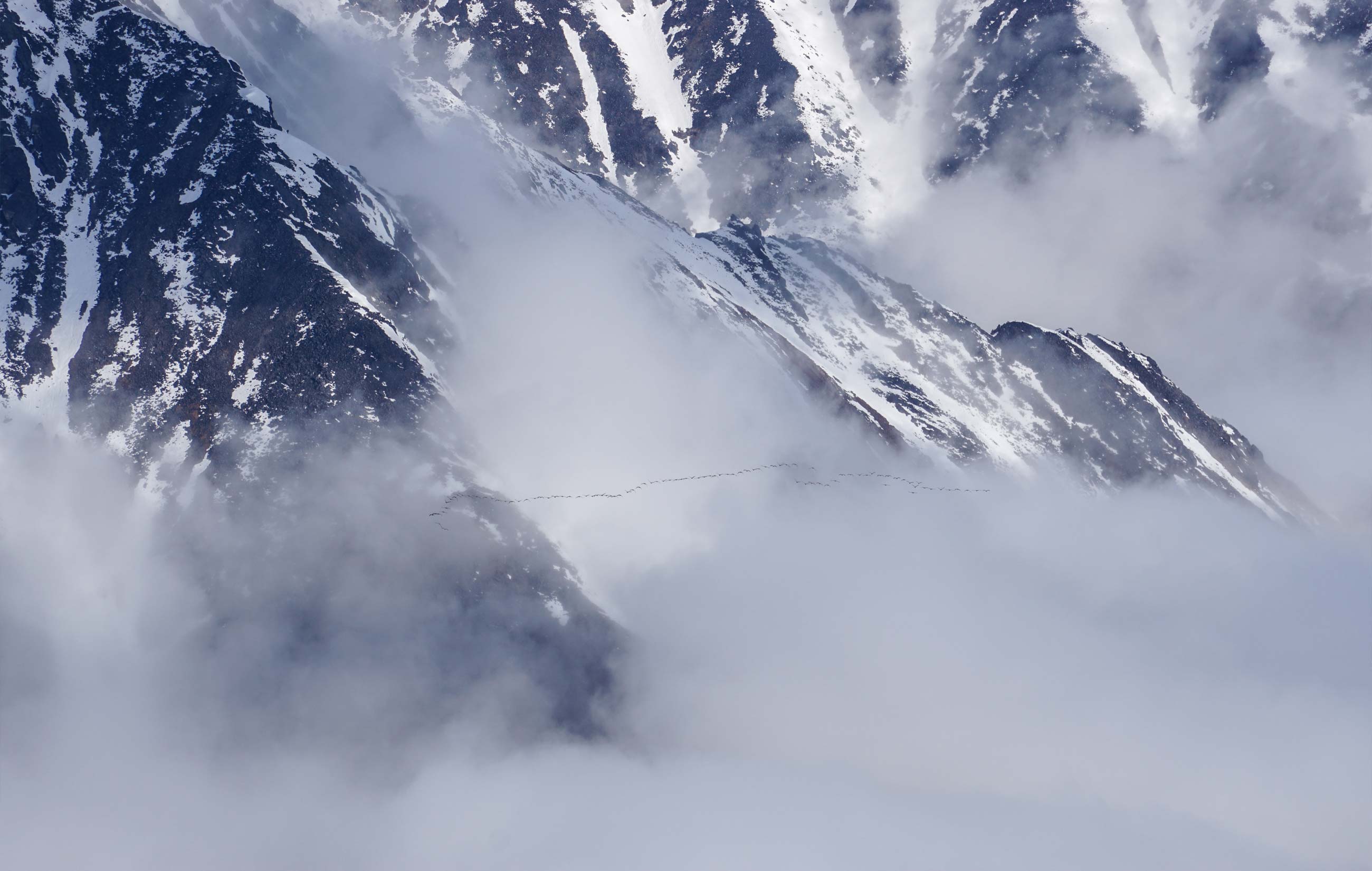
Stretching across the Northern half of Alaska for over 600 miles east to west, the Brooks Range is larger than the state of Colorado and one of America’s last great wilderness areas. North of the Brooks Range is the Arctic Coastal Plain, an area of stark beauty with vast reserves of oil and natural gas. The Arctic National Wildlife Refuge (ANWR) encompasses the eastern part of the Brooks Range and this coastal plain and is home to one of the most intact natural ecosystems in the world. The plains are critical calving grounds for thousands of caribou that come here each year to complete the world’s longest terrestrial migration.
Though the Brooks Range is stacked with hundreds and hundreds of stunning peaks, it is not really a ski destination. The first issue with skiing in the Brooks Range is surprisingly the lack of snow. In winter, temperatures range from -50 F to 0 degrees and snowfall averages a mere 45 inches. The extreme cold combined with desert-like precipitation patterns generate a snow pack characterized by facets; many, many facets. And what snow does fall mid-winter melts quickly come spring as the sun shines for 21 hours a day by mid-May. This unique combination of weather and latitude means most south faces are partially bare by the time you can access them, and any aspect that does hold snow is likely to be knee deep in facets, slush, compacted avalanche debris, or rarely, pow.
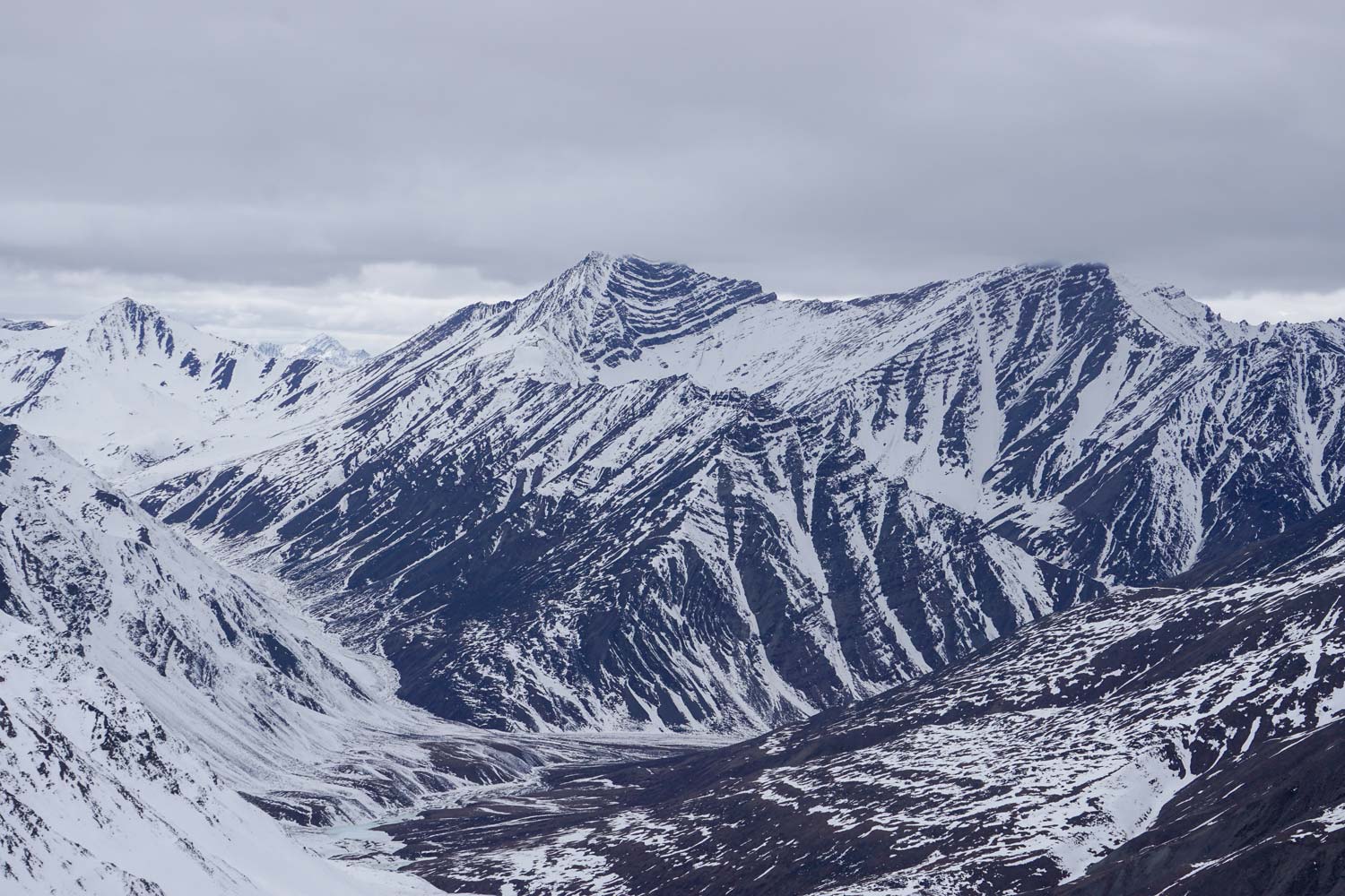
The second challenge in backcountry touring in the Brooks Range is access. A single, 500 mile long road called the Dalton Highway accesses the entire region from Fairbanks. Also known as the North Slope Haul Road, this mostly gravel road was built in 1974 to support the trans-Alaska pipeline, and is the conduit that supplies the Prudhoe Bay oil fields. Unless you hire a local bush plane, you can only enter the Brooks Range from this highway corridor. Our plan was to tour from the road at Atigun Pass which is the highest point along the road where it crosses over the Brooks Range. Touring to the west from Atigun Pass, we entered the Gates Of The Arctic National Park, a national park that doesn’t hold a single road or trail.
There are no guidebooks to the area, and we could not find any other trip reports, so we planned our eight day tour based on satellite imagery, advice from friends, and a cherished copy of Bob Marshall’s Alaska Wilderness book. Over the course of eight days we hoped to complete a 40-mile loop that would take us over three passes including the Continental Divide, and allow us to make an attempt at riding a particularly enticing peak named Oolah Mountain. I planned the tour itinerary with my ski partner Eli, and we invited two other friends, Jocelyn and Cody, to join us on this trip of a lifetime.
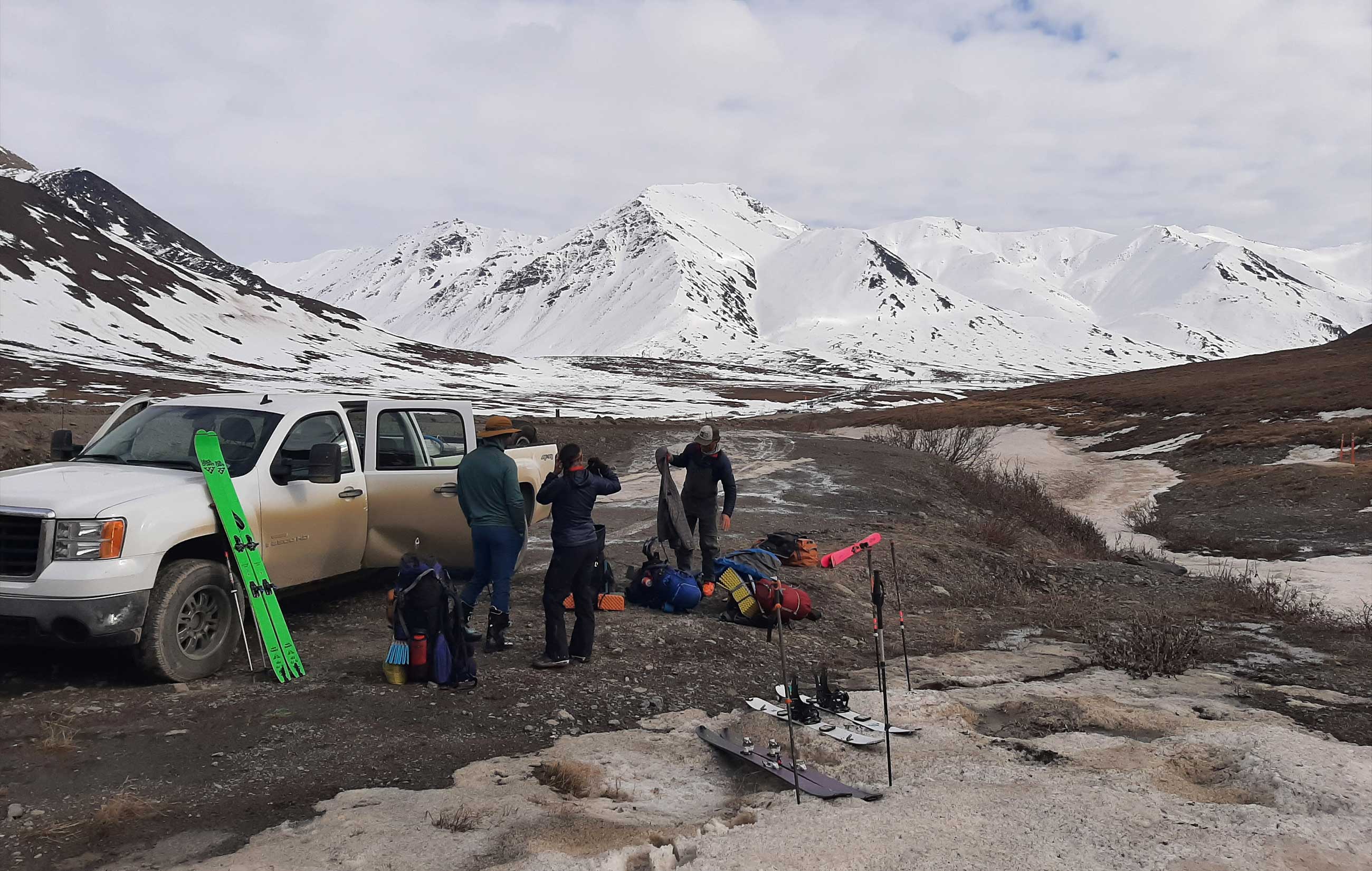
Day 1 - Drive, gear up, get to camp
We met at the house in Fairbanks early and everyone was excited to begin the long and bumpy drive. After several hours of driving we passed into the Arctic circle, marking the official latitude of the midnight sun. The first 250 miles north of Fairbanks also passes through the western portion of the Boreal Forest; a landscape known for its dwarf spruce trees. It is not the scenery that comes to mind when one envisions Alaska, but it’s a great reminder of how immense and varied the state is.
Eventually, we hit the town of Coldfoot, which along with the neighboring town of Wiseman, provides the only services along the 500 miles of desolate road between Fairbanks and the town of Deadhorse, which sits at the end of the Dalton Highway. These two towns mark the transition from vast spruce forest to the mountainous terrain of the Brooks Range. Soon we pass a sign announcing the “Farthest North Spruce”, and just like that, the trees disappear giving way to mountains, rocky outcrops and broad sweeping valleys.
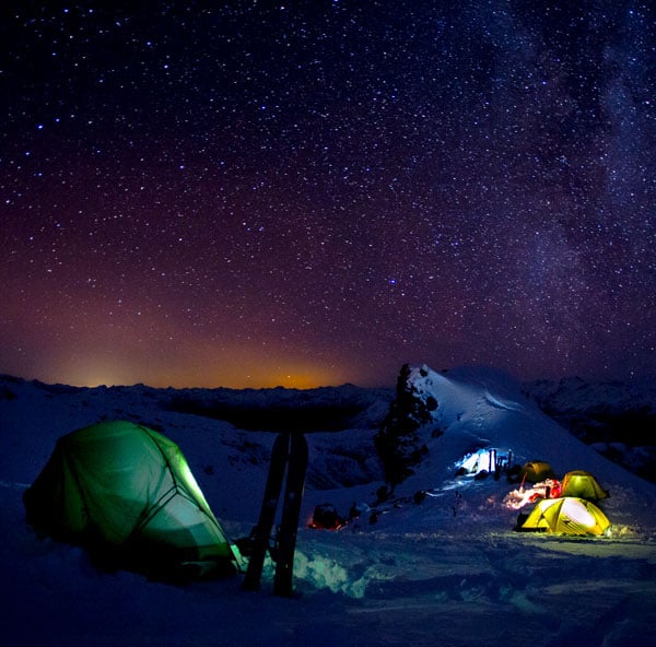
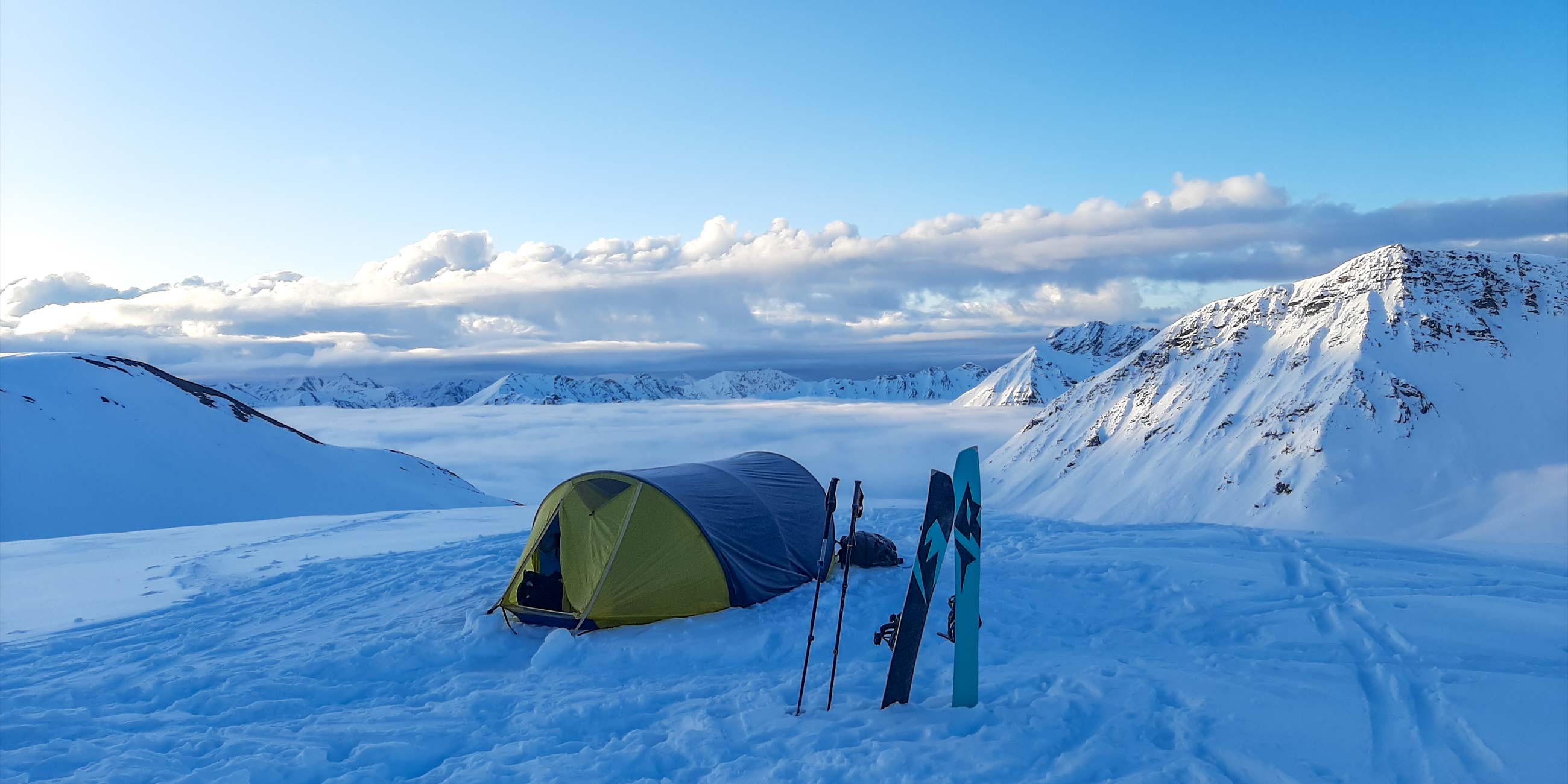
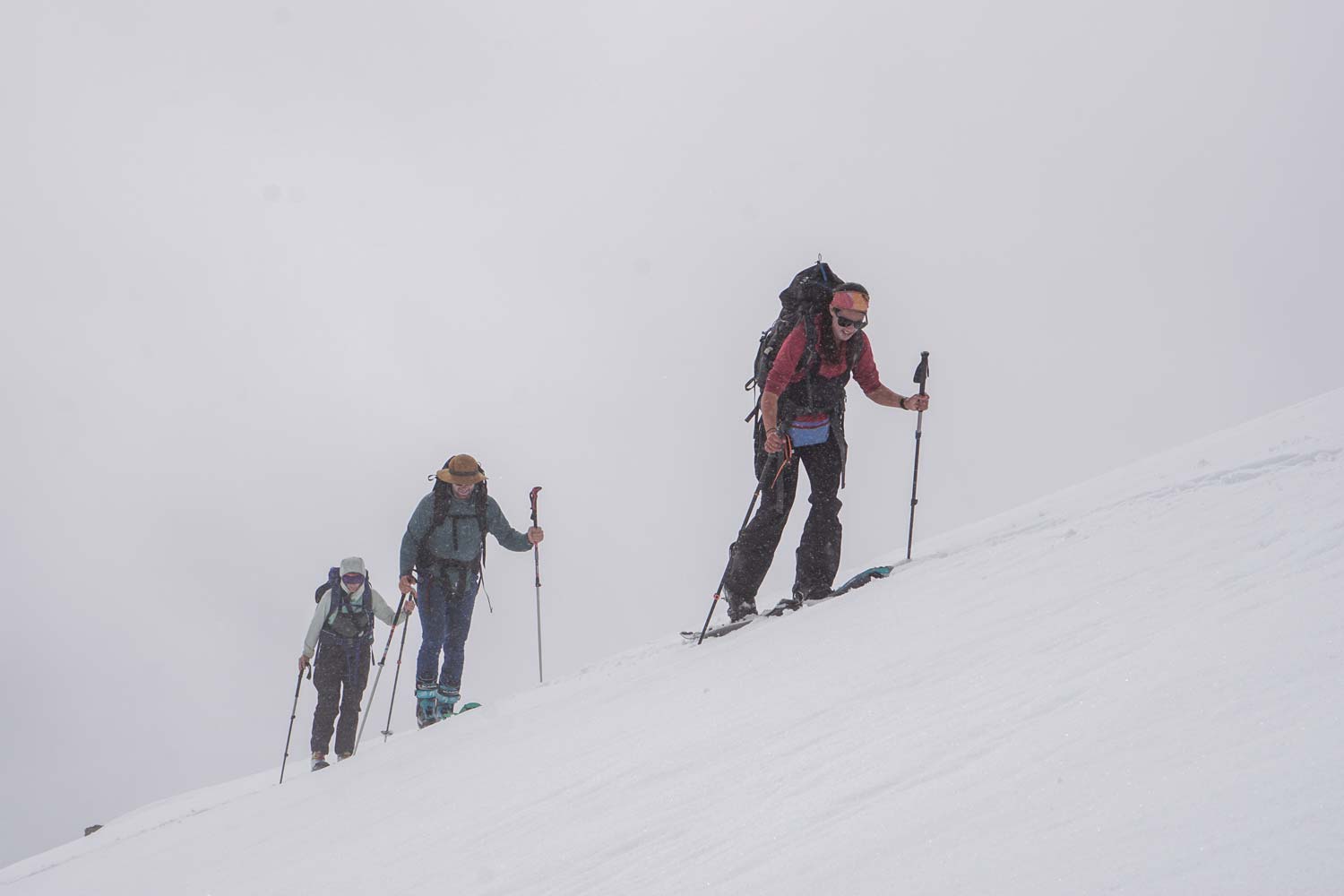
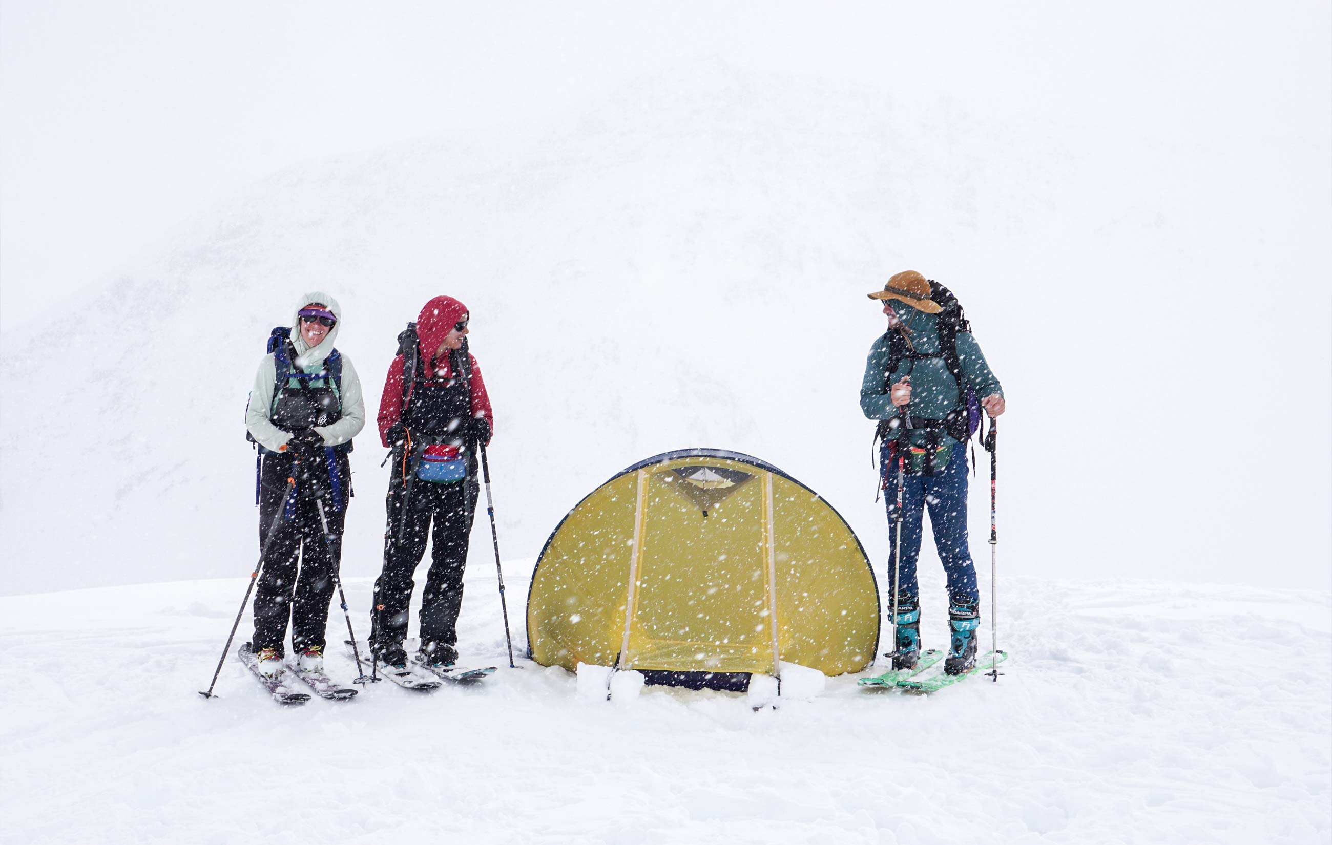
Continuing north we climb onto the Chandalar Shelf before arriving at our destination, Atigun Pass. Our first view of the zone leaves us a bit dismayed by the lack of snow close to the road, but undeterred we started gearing up to skin away from the road and make our first camp in the wilderness that night.
With super heavy packs on our shoulders, and weak, collapsing snow under our skis, the first few miles of touring were slow going. But after a couple hours of slogging, the touring got easier as the snow got firmer as we ascended our first pass. Enamored by the expansive views of the surrounding peaks, we decided the top of the pass would make the perfect first camp.
Day 2 - The slog to the divide
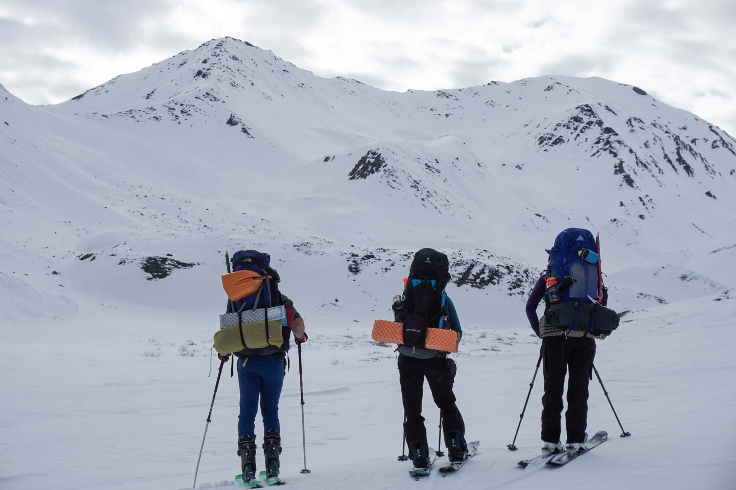
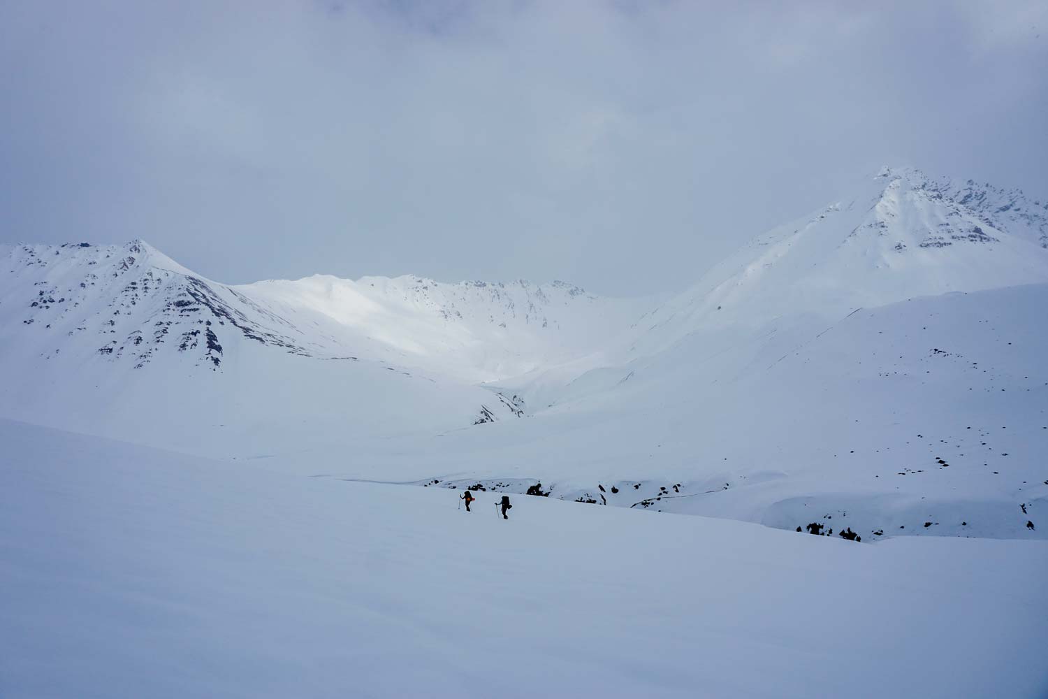
The next day we had about 10 miles to travel to the Continental Divide, and all day to do it. We began with a downhill ride down a low angle gully with mostly firm snow. Descending with heavy packs proved challenging, but we all made it down in one piece. We hit the upper reaches of the West Fork of the Atigun and transitioned to skinning to begin the long, slow climb to the top of our next pass.
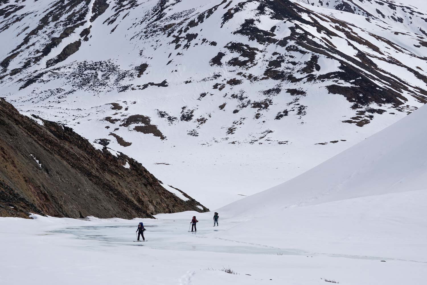
We started skinning on top of the icy overflow of the river, laying tracks alongside the paw prints of a momma grizzly and her cubs. The valley bottom was covered in animal tracks, all heading out of the mountains, down to the lower elevation snow-free plains in search of food.
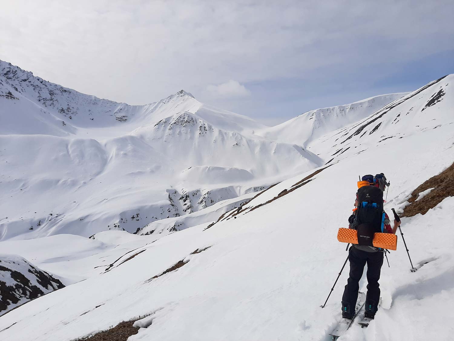
As we kept climbing, the day warmed up. The terrain was complex and we had to regularly regroup to assess the preferred route. It was a hot, side-hilly slog, which we called “contouring” to make it sound more bearable. The snow was variable with a lot of pockets of isothermal crud that kept collapsing. A few hours later we finally made it to the top of the second pass, the Continental Divide.
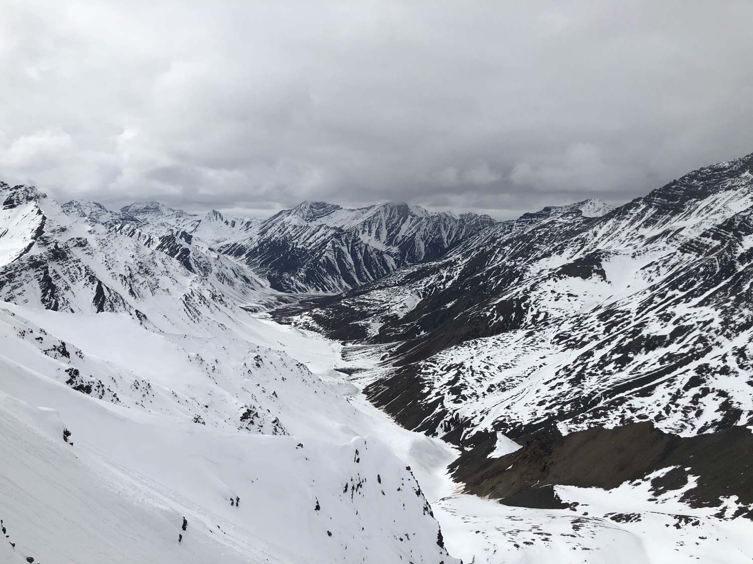
Our excitement of reaching the high point of our tour quickly died as we looked over into the next valley. The valley bottom was dry and there was a steep, narrow descent on the other side of the pass to get into it. Oolah Mountain also looked really burnt out already and the line we had hoped to ride did not go.
Seeing this made us question whether continuing on was the right thing to do. If we kept going, it looked like we would spend the next week dry hiking instead of skinning and riding. Was it worth it to keep going just to complete our itinerary or should we adapt to the conditions in front of us?
After discussing the options over lunch, we decided to turn around and set up camp on the east side of the pass where there was still plenty of snow and exciting terrain.
Day 3 - Working with the weather
After a very long day getting to the pass, we enjoyed sleeping in while we waited for stormy weather to clear. Without any trees, travel in cloudy conditions was challenging. Eventually we skinned up to the ridge behind camp and scouted potential lines from there. After a few laps, the weather quickly deteriorated.
During breaks in the cloud cover, the hot sun and greenhousing drove temperatures to well above freezing. This turned the snow into mush and soon the skiing became wading in deep slop.
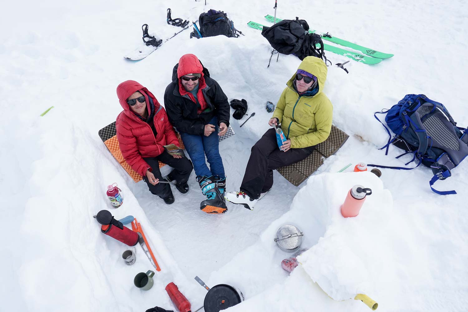
With less than desirable conditions, we returned to camp. We napped and read through the afternoon while the weather pattern moved through. By the time we emerged from our tents, the temperature dropped and there was a light dusting of snow on the ground.
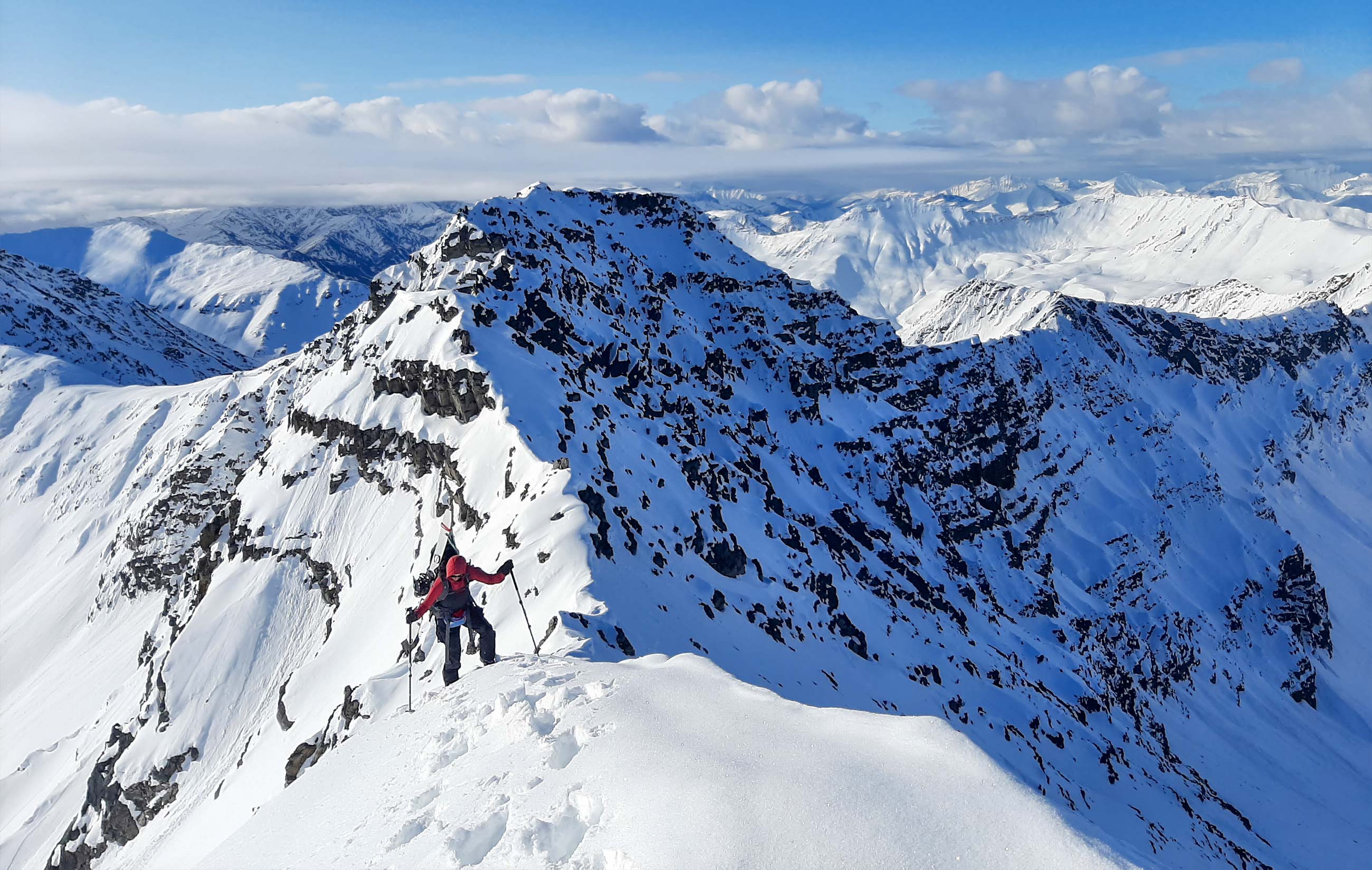
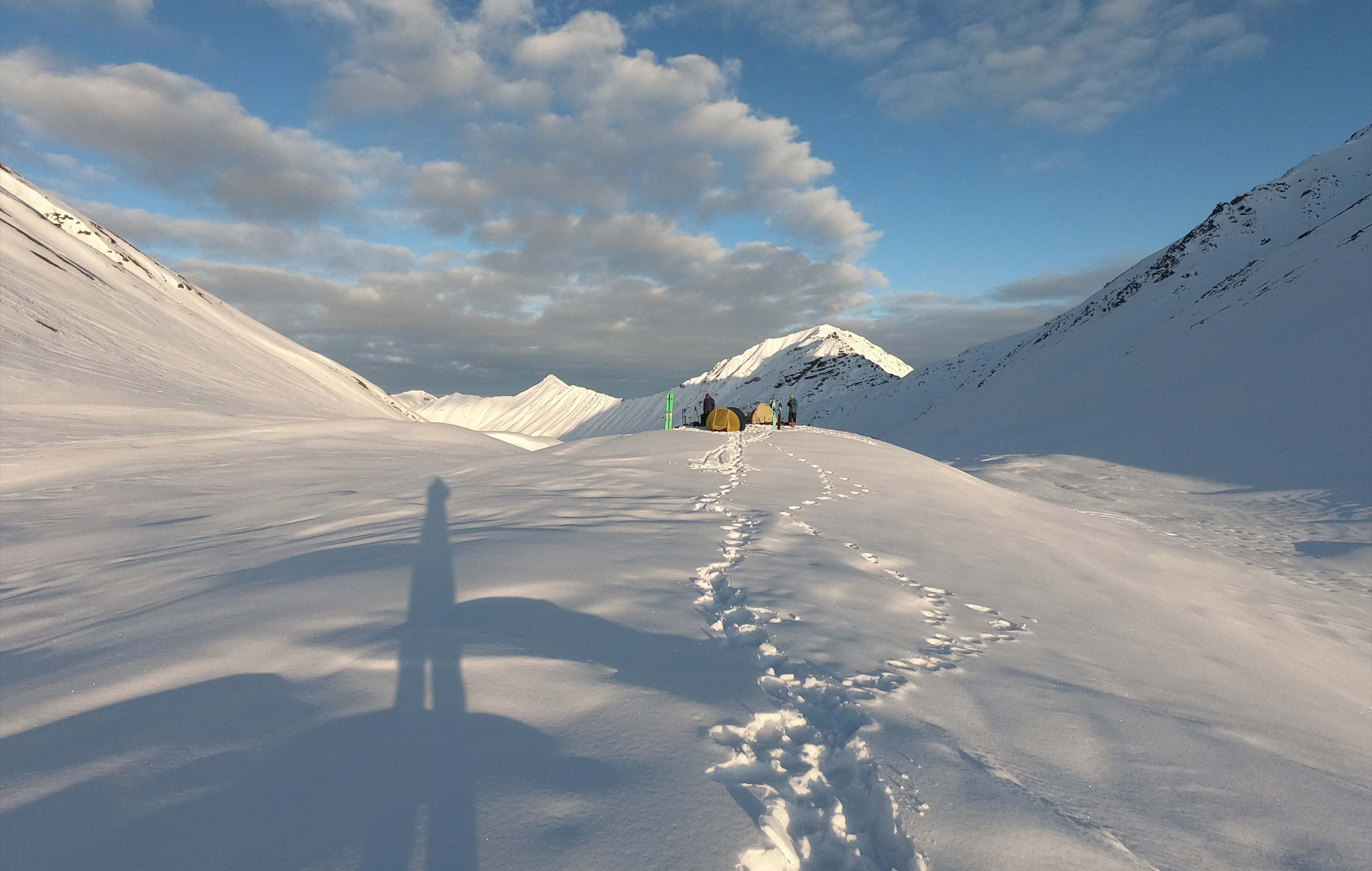
Day 4 - First summit day
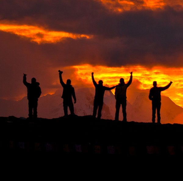
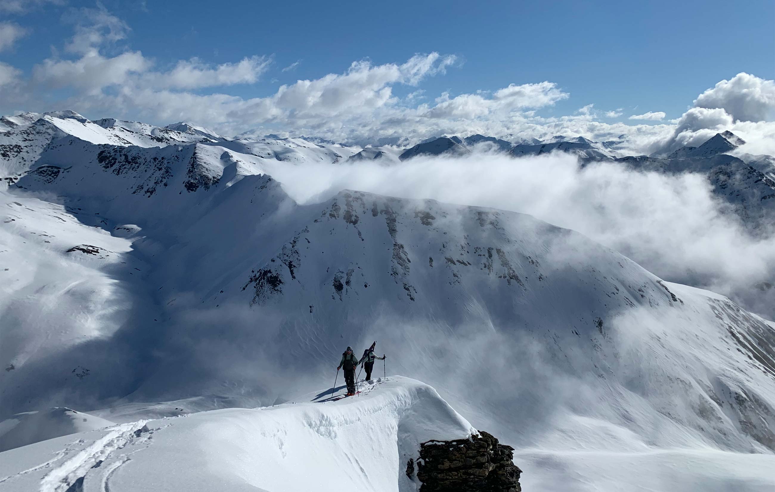
We woke up early to climb the tallest peak that we could see from our basin. Low clouds filled the valley below, but it was finally clear up above. With a solid refreeze last night, we felt good about the stability and set out towards the top. We summited by 830 am and were awestruck by the scene. Clear and sunny, 360 mountain views as far as the eye could see. A train of white-fronted geese flew above us, nearing the end of their 6,000 mile-long migration.
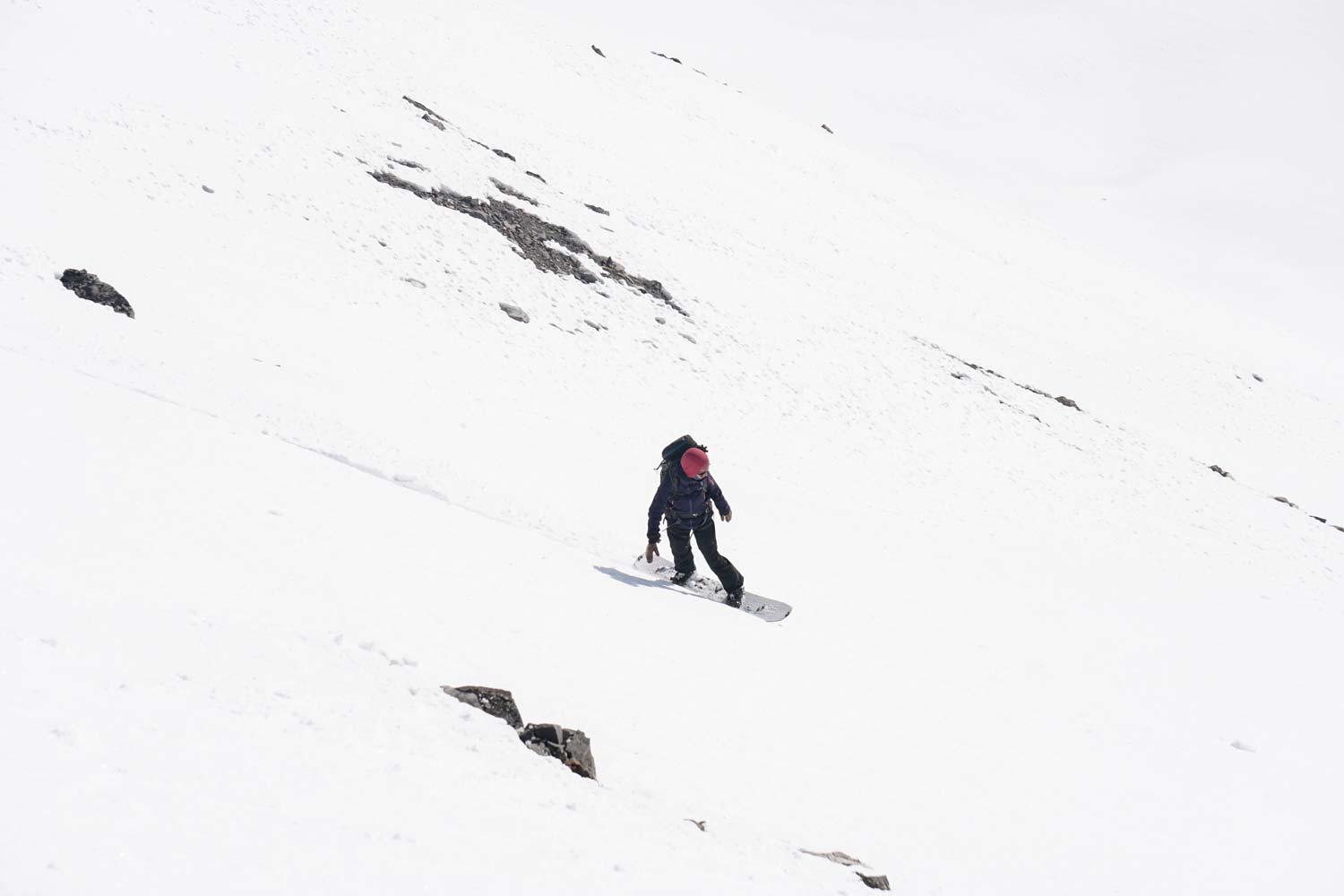
We dropped in right as the snow was warming up and managed to get pretty good corn turns. True to form, there were a few punchy spots that caught us off guard. Because it was still early, we decided to ski across to a different aspect in the cirque across the valley from camp. Slowly the clouds started to close in, but we kept skiing until vertigo started to really get to us.
Once everyone was back we all napped in the clouds while it snowed on and off. There was a break where we all got out to eat dinner before the snow really picked up. We retreated to our tents early for the evening.
Day 5 - More weather and a move
We woke up to a fresh layer of snow the next morning. Having tracked up nearly every slope above camp, we decided to go check out a northwest face that dropped down into an adjacent basin. By the time we got to the top, however, we were fully in a whiteout which dashed any hope of riding into the new zone.
We all knew by now that this trip would be nothing like we planned, but we were also all set on making the most of it. You never really know what to expect in the mountains, and the group can make or break it. Despite conditions thwarting our original plans, everyone was positive and just happy to be there. I think in some ways that is more the sign of a good trip than having everything go your way.
We decided it was best to bump back to the first basin we had camped in. What happened next was a humid downhill slog through hot, soupy, knee-to-thigh deep, variable mush. The travel was much slower than expected, and we soon became accustomed to the whumpfing sound of snow settling beneath our feet. On several occasions while skinning across small lakes on the valley floor, we sent cracks across the entire lake surface. Ironically, this provided definition to the snow as we navigated through the seemingly endless and indiscernible slopes.
There were numerous faceplants and tipovers, as one or both skis would dive into the mush. In this type II fun, all we could do was laugh, dig deep, and keep cruising along. Exhausted, we finally made it back to our first camp zone, quickly ate, and then retreated to our tents. We went to sleep hopeful, but unsure of what our last day would hold.
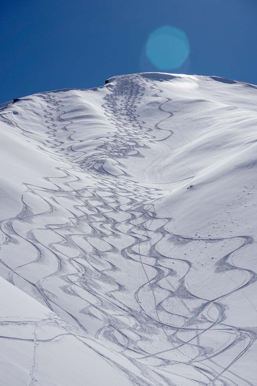
Day 6 - 12 hour pow day
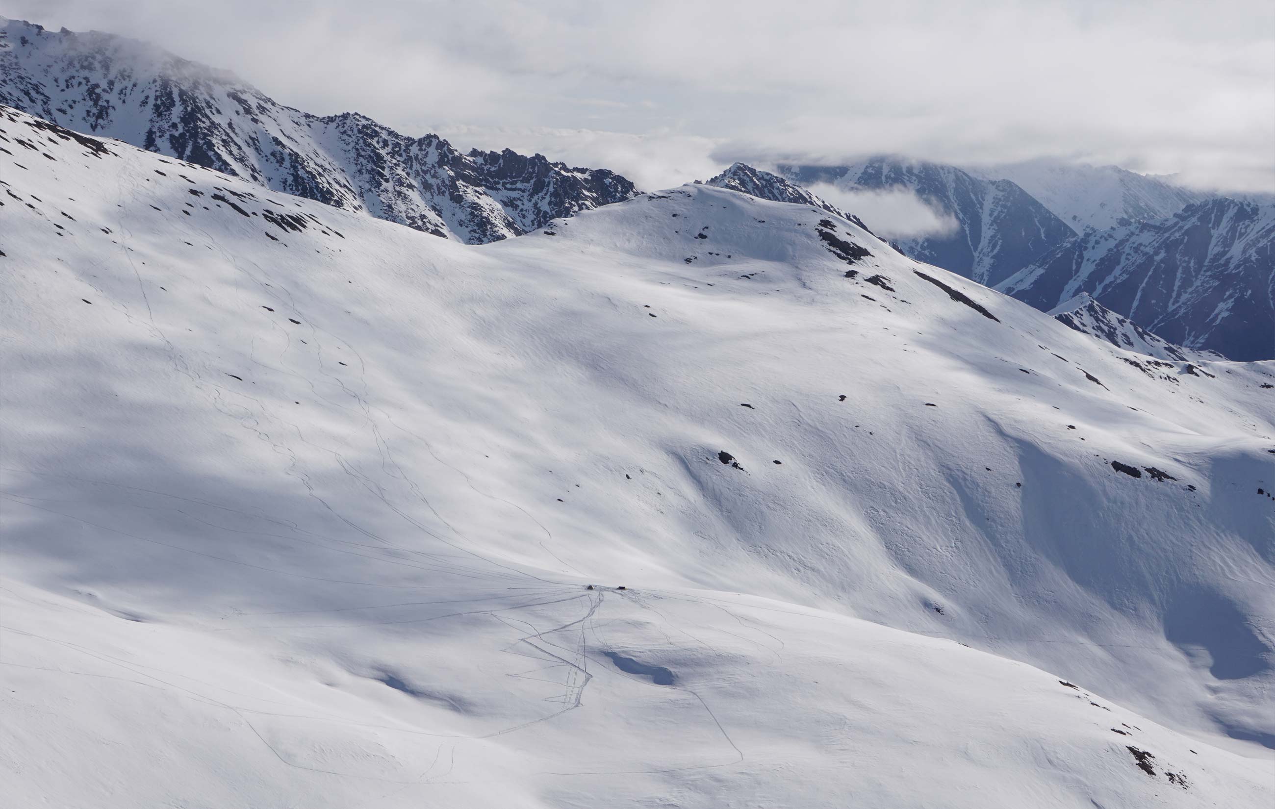
worth it for today! We took off for the peak looming above camp, but maintained low expectations. Upon gaining the ridge, we found soft, sparkling snow on the north face and excitedly kept ascending. After setting a boot pack and topping out, the clouds cleared once again. We were awestruck looking out over the vast sea of mountains and now familiar sounds of honking geese. Dropping in, we found 1000’ of boot-top, cold, fluffy powder!
We all went back for more and eventually rounded out more than 12 hours of riding. The light that time of year in the Arctic is remarkable. Looking back up at the slope, we couldn’t help but laugh at how we had skied every inch of it. It was as if a heli-ski operation had been there!
Day 7 - Starting the journey home
We woke early and packed up camp with that familiar feeling at the end of any trip - excited to get back to a shower and the luxuries of home, but sad to be leaving a place where all of life’s distractions can be put on hold.
It was apparent how much had melted out in the last week, as shrubs poked out of thin patches of snow and parts of the creek were now free flowing. We still managed to make it all the way back to the truck with skis on, linking linear patches of degrading snow and overflow ice along the creek. Reluctant to head back to Fairbanks and civilization, we drove over Atigun pass and further onto the North Slope. We saw caribou, moose, mountain goats, and hundreds of migrating geese. It was fitting to watch the geese end their journey as we were ending ours. After our brief northern safari, we headed back south and camped in the shadow of Sukakpak Mountain along the banks of the West Fork of the Koyakuk, enjoying one last night above the Arctic Circle.
Day 8 - Reflecting on the journey
As we drove back across the interior, we witnessed the rapid onset of spring in Alaska’s interior. Rivers that had been covered in ice a week earlier had fully thawed, and previously skeletal tree frames now donned full coats of leaves. In the high latitudes, the seasons always march forward.
Bouncing south on the rough highway, we reflected on our trip. We felt humbled by our experience in the mountains and the opportunity to witness the profound and beautiful onset of spring in the Arctic, yet we could not ignore the sanctimonious side of our trip. Sure, we were human-powered once we clicked into snowboards and skis, but what about the 325 miles we had driven from Fairbanks, or the 2,000 miles a few of us had flown to get to Fairbanks? What about the resources that were used to create our food and gear? The drive back made it impossible to ignore the dependence of recreational enthusiasts on fossil fuels; after all, the trans-Alaska pipeline parallels the highway, a road that exists to serve oil exploration on the North Slope.
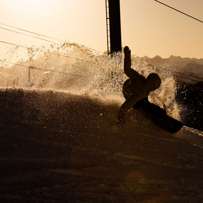
.jpg)
Too often, outdoor adventurers highlight the human-powered aspects of their hobbies while ignoring their carbon-dependence. This reality is something that the outdoor industry and we as recreationalists must be honest about. Love for the environment and spending time in wilderness areas does not make you a conservationist or assure that you live sustainably.
Our trip was a celebration of pristine mountains that we hope will remain wild, yet we also confronted our own culpability by exploring them. We hope some of the value from this adventure will be in showing people what an incredible, rugged, and fragile place this small piece of the Alaskan Arctic is, and how much we have at stake to lose.
With this to think about, we also remarked on just how lucky we are to have been able to take part in such a trip. To be somewhere so remote, with no other human presence was truly an incredible experience.
Jones Adventure Grants
Turn your dream adventure into reality.
Apply now for the 2022 Jones Adventure Grants.
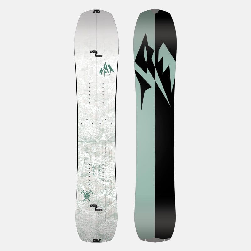
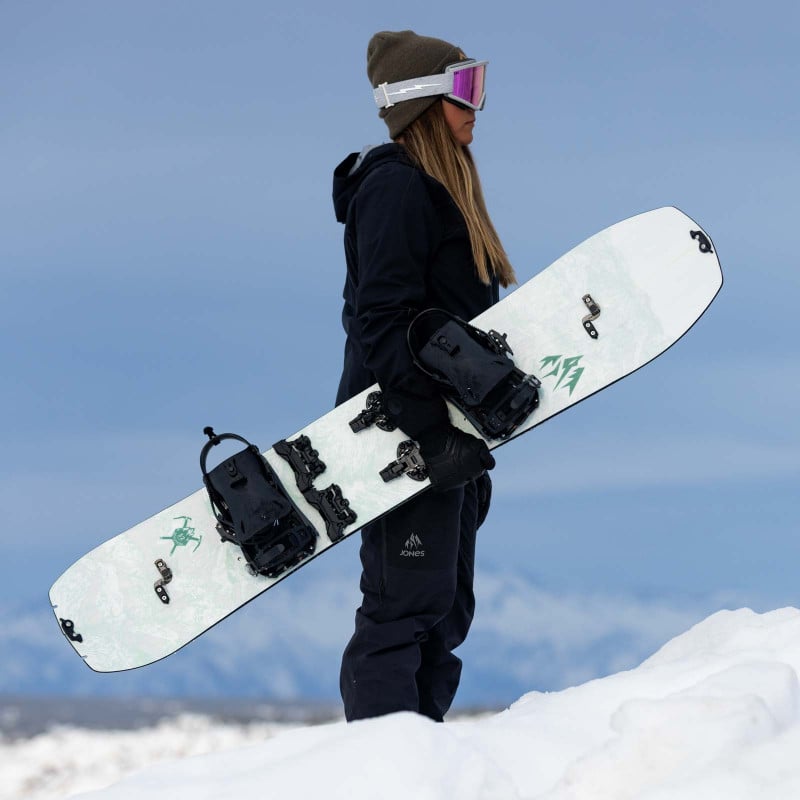
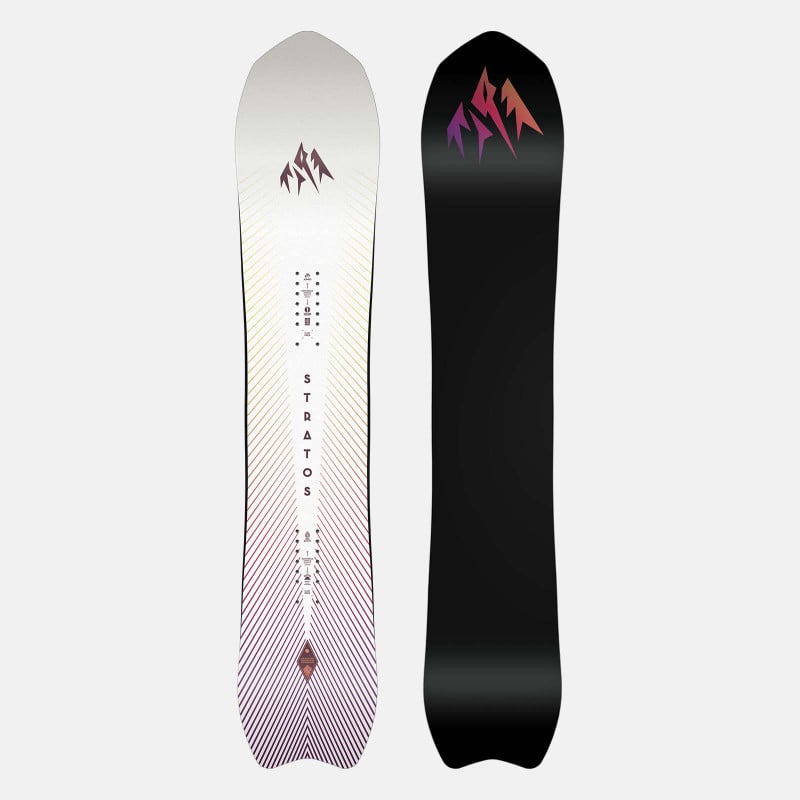
Gear for your next adventure

Share & Comment
Our Mission
Design innovative mountain gear that sets new performance standards and be a leader
in
manufacturing sustainability, environmental outreach and backcountry education.


© 2024 Jones Snowboards. All rights reserved.
Nidecker North America, 11253 Brockway Rd. Suite E202, Truckee, California 96161 - USA